Wards
The population of the Township of Ramara is 10,377 people (Statistics Canada, 2021), and it is divided into five electoral wards, each represented by one local Councillor, along with a Deputy Mayor and a Mayor.
View our interactive mapping to know which ward you are in. Remember to click Municipal Ward Boundary layer found on the left hand side of the GIS mapping tool. If you can't find the layer, click the layer button the top left and search the name in the Filter section.
View Interactive Mapping
Ward Descriptions and Maps
Presented below are the descriptions and maps from Ward Boundary Bylaw 2021.45 for each ward.
View full map
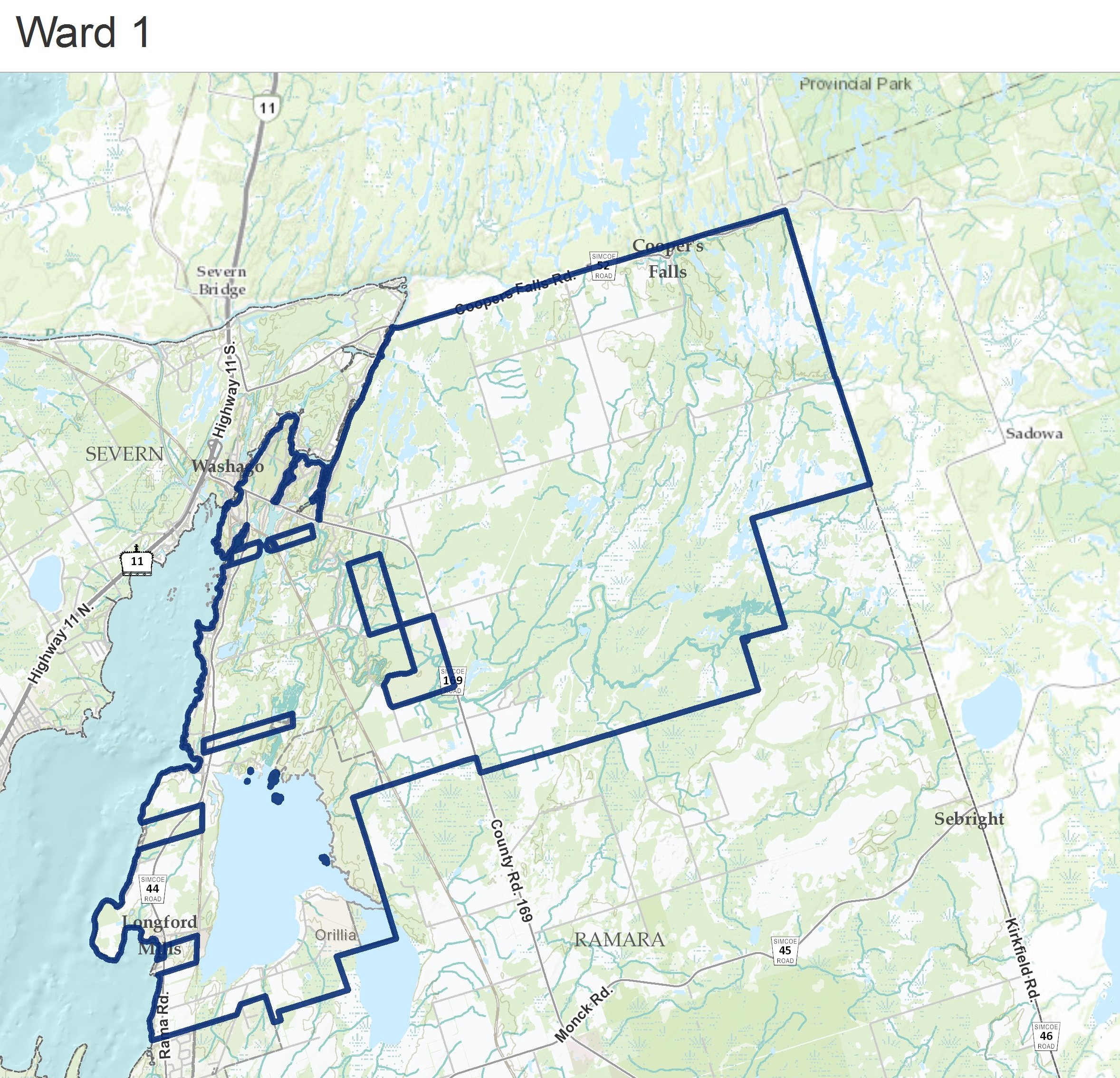
Ward 1
|
Beginning at the Northern most point of the Township, south of the Black River at Hwy 6, the boundary travels:
- South along Ramara’s eastern border to the southern boundary of Lot 21 Concession I;
- West along the southern boundary of Concession I to the north-western corner of Lot 16 Concession H;
- South along the eastern boundary of Lot 15 to the south-east corner of Lot 15 Concession G;
- West along Concession G to the north-western corner of Lot 14 Concession F;
- South along the eastern boundary of Lot 13 to the south-east corner of Lot 13 Concession F;
- West along Concessions F to County Rd. 169;
- North along the midline of County Rd. 169 to the southern boundary of Lot 15 Concession 5;
- West along Concessions 5 to the north-western corner of Lot 18 Concession 4;
- South along the boundary of the Rama First Nations Parcel to its Southern boundary;
- West along and past the southern boundary of the Rama First Nations Parcel to the northwestern corner of Lot 20 Concession 2;
- South to the southern property line of 3675 Airport Rd;
- West and south along the southern property lines of 3675 and 3785 Airport Rd to the eastern boundary of the Parcel;
- North and west along the eastern and northern boundaries of the Rama First Nations Parcel to Lake Couchiching;
- North and east along Ramara’s border to northern most point of the Township.
|
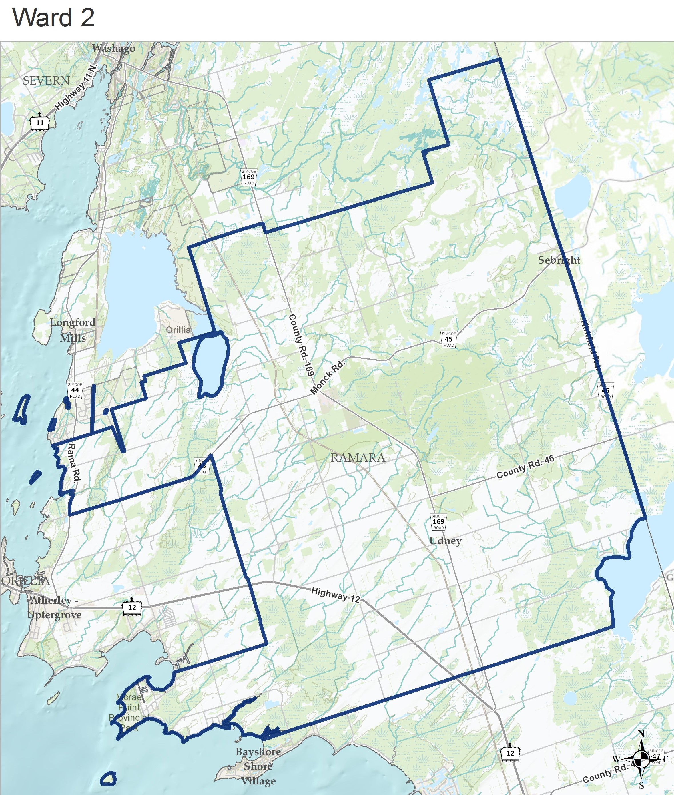
Ward 2
|
Description
Beginning where the southern boundary of ward 1 intersects with the eastern border of the Township, the boundary travels:
- South along Ramara’s eastern border to Lake Dalrymple;
- Southwest along Lake Dalrymple to Concession Rd. 7;
- West along the midline Concession Rd. 7 to Lake Simcoe;
- North along the lakeshore to the southern property line of 4166 Glencoe Beach Rd.;
- East along the southern property line of 4166 Glencoe Beach Rd. toward Mcrae Park Rd., and along the midline of Mcrae Park Rd. to Sideroad 20;
- North along the midline of Sideroad 20 to Monck Rd (Hwy 45);
- Southwest along the midline of Monck Rd. to Rama Rd. (Hwy 44);
- North and west along the midline of Rama Rd. and the property line of 4358 Fern Resort Rd. to Lake Couchiching;
- North along the shoreline to where the shoreline intersects with the southern boundary of ward 1;
- East and north along the southern boundary of ward 1 to the eastern border of the Township.
Map
|
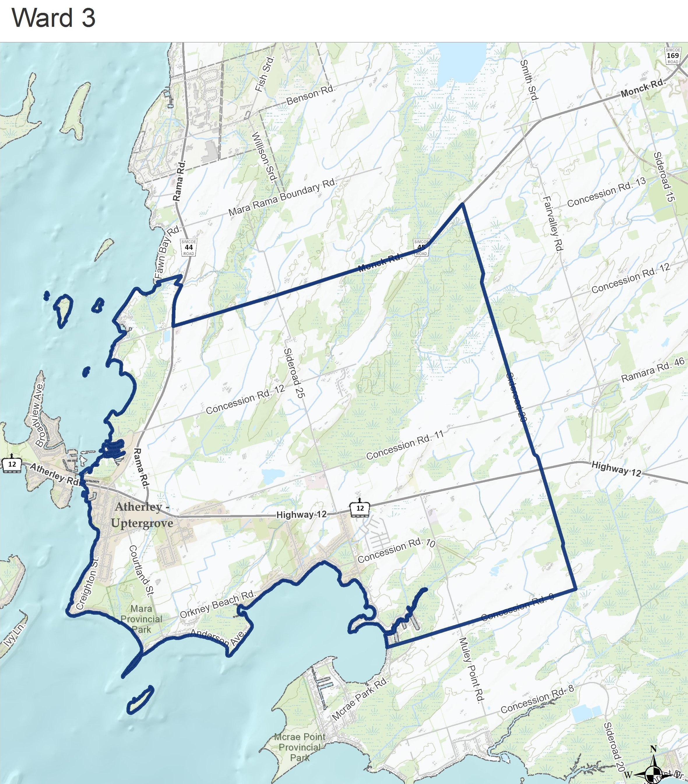
Ward 3
|
Description
Beginning at the intersection of Monck Rd. and Sideroad 20, the boundary travels:
- South along the midline of Sideroad 20 to Mcrae Park Rd.;
- West along the midline of Mcrae Park Rd. and the ward 2 boundary to Lake Simcoe.
- North along the shoreline to the northern property line of 4358 Fern Resort Rd.;
- East the ward 2 boundary to Sideroad 20.
Map
|
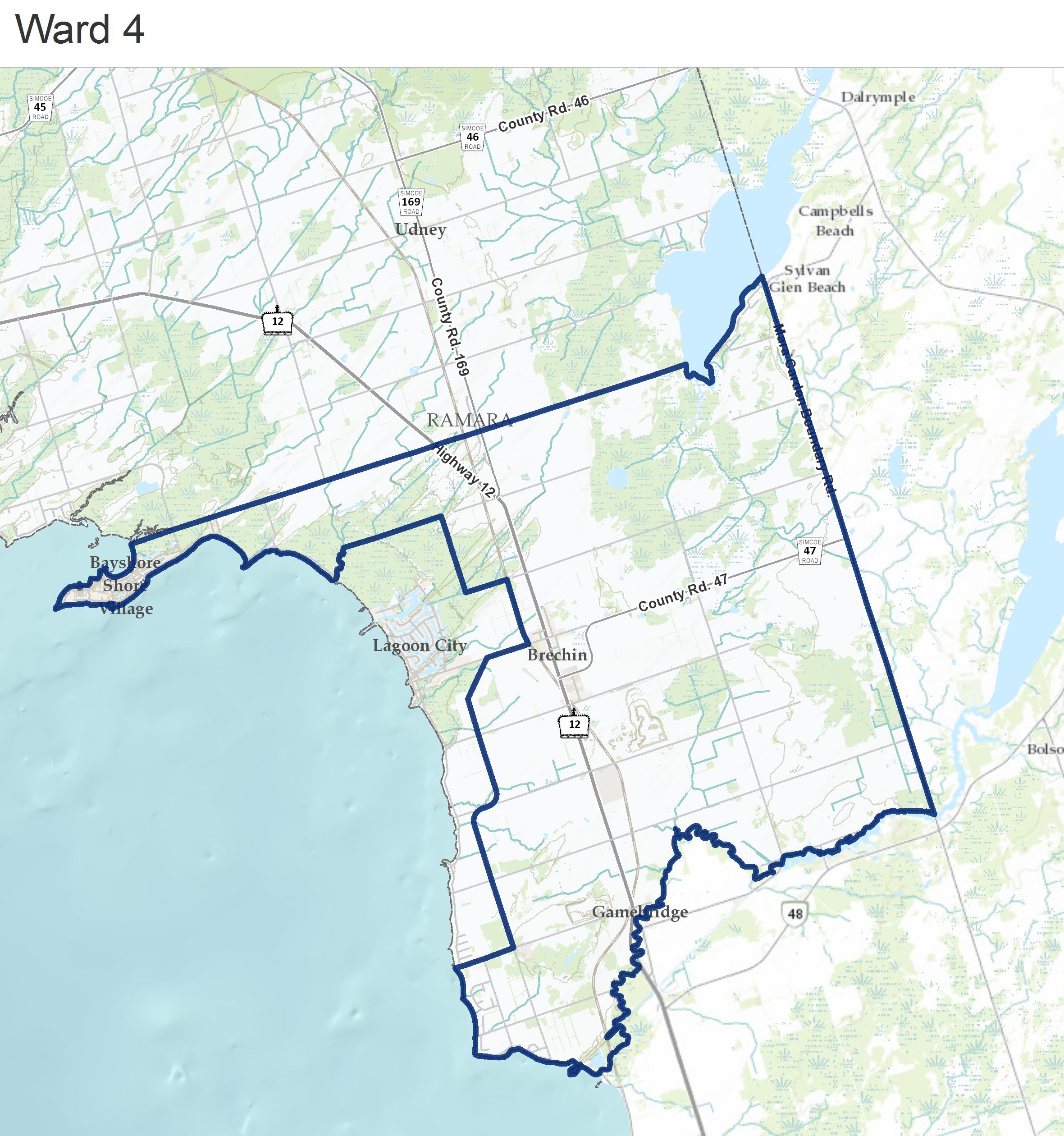
Ward 4
|
Description
Beginning at where the southern shore of Lake Dalrymple intersects with the eastern border of the Township, the boundary travels:
- South, west, and north along the Township’s border to where Concession Rd. A meets Lake Simcoe;
- Inland, east and north along the boundary of ward 5 (see below) back to the shore line;
- North along the shoreline to Concession Rd. 7;
- East along the midline of Concession Rd. 7 to Lake Dalrymple;
- South and east along the shoreline of Lake Dalrymple to the Eastern border of the Township.
Map
|
Ward 5
|
Description
Beginning at the mouth of the tributary on Lake Simcoe just South of Amilia Rd., the boundary travels:
- North along the river to Concession 6;
- East along Concession 6, to where it intersects with the eastern property line of 30 Paradise Blvd;
- South along the eastern boundary of Lot 13 to Concession 5;
- East along Concession 5 to the Railway; o South along the Railway to Ramara Rd. 47;
- West and south along the midline of Ramara Rd. 47 to Concession Rd. A;
- West along the midline of Concession Rd. A to Lake Simcoe;
- North along the shoreline to the tributary south of Amilia Dr.
Map
|